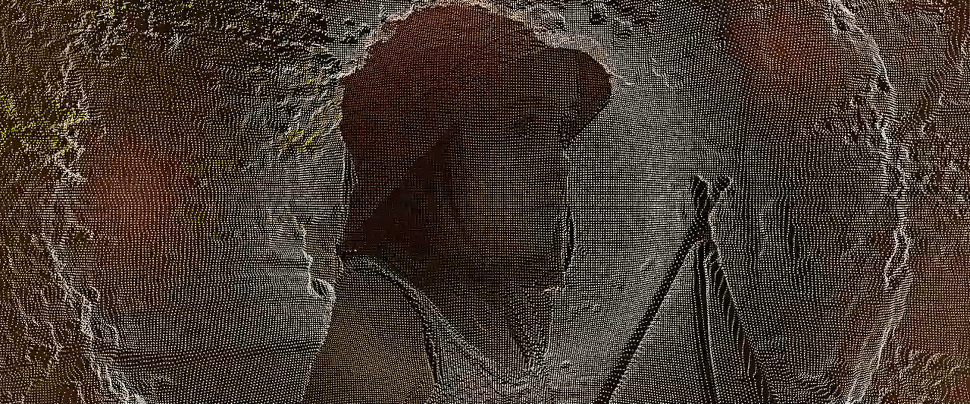
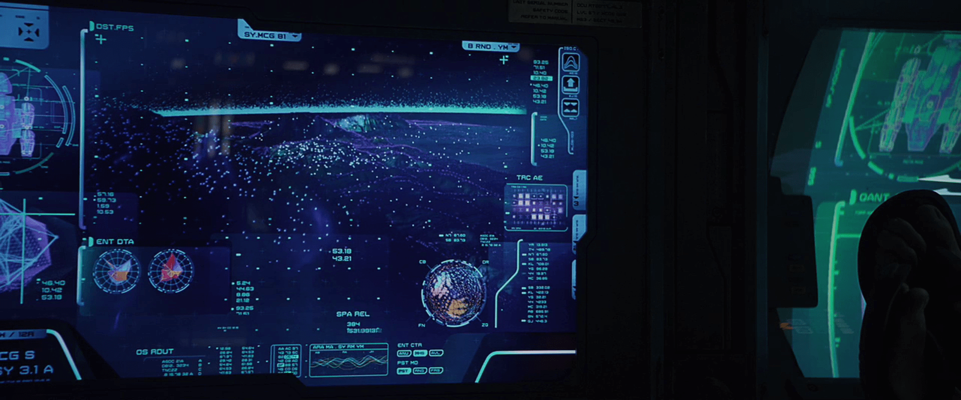
When Ibanez and Barcalow enter the atmosphere in the escape pod, we see a brief, shaky glimpse of the COURSE OPTION ANALYSIS interface. In the screen grab below, you can see it has a large, yellow, all-caps label at the top. The middle shows the TERRAIN PROFILE. This consists of a real-time, topography map as a grid of screen-green dots that produce a shaded relief map.

On the right is a column of text that includes:
- The title, i.e., TERRAIN PROFILE
- The location data: Planet P, Scylla Charybdis (which I don’t think is mentioned in the film, but a fun detail. Is this the star system?)
- Coordinates in 3D: XCOORD, YCOORD, and ELEVATION. (Sadly these don’t appear to change, despite the implied precision of 5 decimal places)
- Three unknown variables: NOMINAL, R DIST, HAZARD Q (these also don’t change)
The lowest part of the block reads that the SITE ASSESSMENT (at 74.28%, which—does it need to be said at this point—also does not change.)
Two inscrutable green blobs extend out past the left and bottom white line that borders this box. (Seriously what the glob are these meant to be?)
At the bottom is SCAN M and PLACE wrapped in the same purple “NV” wrappers seen throughout the Federation spaceship interfaces. At the bottom is an array of inscrutable numbers in white.
Since that animated gif is a little crazy to stare at, have this serene, still screen cap to reference for the remainder of the article.

Design
Three things to note in the analysis.
1. Yes, fuigetry
I’ll declare everything on the bottom to be filler unless someone out there can pull some apologetics to make sense of it. But even if an array of numbers was ever meant to be helpful, an emergency landing sequence does not appear to be the time. If it needs to be said, emergency interfaces should include only the information needed to manage the crisis.
2. The visual style of the topography
I have before blasted the floating pollen displays of Prometheus for not describing the topography well, but the escape pod display works while using similar pointillist tactics. Why does this work when the floating pollen does not? First, note that the points here are in a grid. This makes the relationship of adjacent points easy to understand. The randomness of the Promethean displays confounds this. Second, note the angle of the “light” in the scene, which appears to come from the horizon directly ahead of the ship. This creates a strong shaded relief effect, a tried and true method of conveying the shape of a terrain.
3. How does this interface even help?
Let’s get this out of the way: What’s Ibanez’ goal here? To land the pod safely. Agreed? Agreed.
Certainly the terrain view is helpful to understand the terrain in the flight path, especially in low visibility. But similar to the prior interface in this pod, there is no signal to indicate how the ship’s position and path relate to it. Are these hills kilometers below (not a problem) or meters (take some real care there, Ibanez.) This interface should have some indication of the pod. (Show me me.)
Additionally, if any of the peaks pose threats, she can avoid them tactically, but adjusting long before they’re a problem will probably help more than veering once she’s right upon them. Best is to show the optimal path, and highlight any threats that would explain the path. Doing so in color (presuming pilots who can see it) would make the information instantly recognizable.
Finally the big label quantifies a “site assessment,” which seems to relay some important information about the landing location. Presumably pilots know what this number represents (process indicator? structural integrity? deviation from an ideal landing strip? danger from bugs?) but putting it here does not help her. So what? If this is a warning, why doesn’t it look like one? Or is there another landing site that she can get to with a better assessment? Why isn’t it helping her find that by default? If this is the best site, why bother her with the number at all? Or the label at all? She can’t do anything with this information, and it takes up a majority of the screen. Better is just to get that noise off the screen along with all the fuigetry. Replace it with a marker for where the ideal landing site is, its distance, and update it live if her path makes that original site no longer viable.

Of course it must be said that this would work better as a HUD which would avoid splitting her attention from the viewport, but HUDs or augmented reality aren’t really a thing in the diegesis.
Narratively
The next scene shows them crashing through the side of a mountain, so despite this more helpful design, better for the scene might be to design a warning mode that reads SAFE SITE: NOT FOUND. SEARCHING… and let that blink manically while real-time, failing site assessments blink all over the terrain map. Then the next scene makes much more sense as they skip off a hill and into a mountain.